2019
NG6018 : Moorland south of Beinn an Dubhaich
taken 5 years ago, 3 km from Kilbride/Cille Bhrighde, Isle of Skye, Scotland
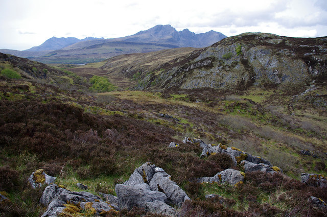
Moorland south of Beinn an Dubhaich
Looking down the glen formed by the Allt nan Leac, to Blaven (centre) and the south end of the Cuillin (left).
 Map © Crown Copyright")
TIP: Click the map for more Large scale mapping
- Grid Square
- NG6018, 4 images (more nearby 🔍)
- Photographer
- Ian Taylor (more nearby)
- Date Taken
- Thursday, 9 May, 2019 (more nearby)
- Submitted
- Friday, 7 June, 2019
- Subject Location
-
OSGB36:
 NG 600 182 [100m precision]
WGS84: 57:11.5128N 5:58.3636W - Camera Location
-
OSGB36: NG 603 182
- View Direction
- WEST (about 270 degrees)