2019
NS3154 : Kilbirnie from Glengarnock
taken 5 years ago, near to Kilbirnie, North Ayrshire, Scotland
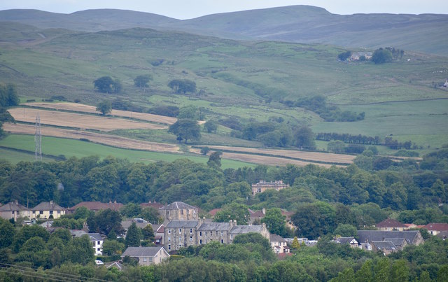
Kilbirnie from Glengarnock
The prominent building closest to the camera is located on Avils Hill, with the Fudstone scheme behind.
In the middle of the picture, nestled in the trees is Moorpark House.
To the top right of the photo is a former water treatment plant which after being derelict for many years has been converted into a private residence.
In the middle of the picture, nestled in the trees is Moorpark House.
To the top right of the photo is a former water treatment plant which after being derelict for many years has been converted into a private residence.
 Map © Crown Copyright")
TIP: Click the map for more Large scale mapping
- Grid Square
- NS3154, 163 images (more nearby 🔍)
- Photographer
- Mark S (more nearby)
- Date Taken
- Saturday, 22 June, 2019 (more nearby)
- Submitted
- Saturday, 22 June, 2019
- Subject Location
-
OSGB36:
 NS 314 541 [100m precision]
WGS84: 55:45.0770N 4:41.2287W - Camera Location
-
OSGB36: NS 324 522
- View Direction
- North-northwest (about 337 degrees)