2019
NZ7605 : Moorland pond and former tramway embankment
taken 5 years ago, near to Glaisdale, North Yorkshire, England
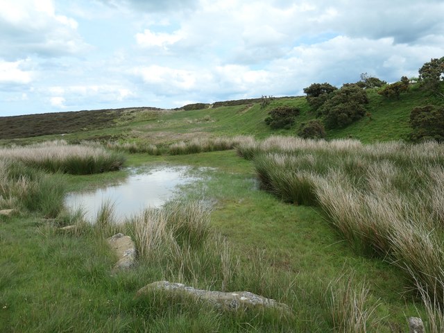
Moorland pond and former tramway embankment
On Glaisdale Low Moor. In the 1890s the embankment was mapped as an 'old tramway'. It must have been a mineral line serving the many quarries on Glaisdale Low Moor.
 Map © Crown Copyright")
TIP: Click the map for more Large scale mapping
- Grid Square
- NZ7605, 25 images (more nearby 🔍)
- Photographer
- Christine Johnstone (more nearby)
- Date Taken
- Sunday, 9 June, 2019 (more nearby)
- Submitted
- Sunday, 23 June, 2019
- Subject Location
-
OSGB36:
 NZ 7657 0501 [10m precision]
WGS84: 54:26.0850N 0:49.2635W - Camera Location
-
OSGB36: NZ 7655 0500
- View Direction
- East-northeast (about 67 degrees)