2019
NT6326 : Baron's Folly
taken 5 years ago, near to Fairnington, Scottish Borders, Scotland
This is 1 of 3 images, with title Baron's Folly in this square
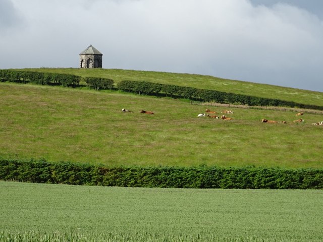
Baron's Folly
Baron's Folly was built as a summerhouse and observatory by Baron Robert Rutherford, of the nearby Fairnington estate around 1780-90. Here it is viewed from the north-east. The folly is Category C Listed.
 Map © Crown Copyright")
TIP: Click the map for more Large scale mapping
- Grid Square
- NT6326, 28 images (more nearby 🔍)
- Photographer
- Philip Halling (more nearby)
- Date Taken
- Sunday, 30 June, 2019 (more nearby)
- Submitted
- Thursday, 4 July, 2019
- Subject Location
-
OSGB36:
 NT 6371 2679 [10m precision]
WGS84: 55:32.0087N 2:34.5904W - Camera Location
-
OSGB36: NT 6404 2727
- View Direction
- Southwest (about 225 degrees)