J3028 : The Mourne Wall, Slieve Meelmore
taken 5 years ago, 5 km SSE of Kilcoo, Co Down, Northern Ireland
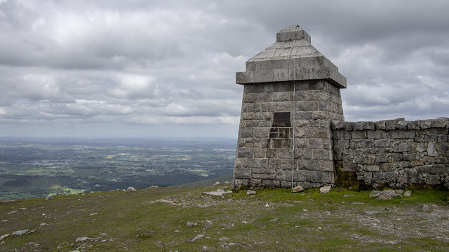
The Mourne Wall is a 22 mile long wall in the Mourne Mountains. It was built between 1904 and 1922 by the Belfast Water Commissioners to enclose their catchment areas in the Mournes and protect the area from the effects of cattle and sheep on the water course Link
. The wall is predominately constructed from local granite using traditional dry stone walling techniques; on average the wall is about 1.5 metres high and 0.8 to 0.9 metres thick. It is not uniform in construction along the entire length - the 'classic' granite wall is only to be found north of Carn mountain and Long Seefin with particularly impressive sections on Slieve Commedagh and Slieve Donard; elsewhere it largely resembles the traditional dry stone walls found elsewhere in the Mournes and south County Down. In places, such as Slieve Muck, the wall is not constructed of granite at all.
- Grid Square
- J3028, 56 images (more nearby 🔍)
- Photographer
- Rossographer (more nearby)
- Date Taken
- Tuesday, 2 July, 2019 (more nearby)
- Submitted
- Friday, 5 July, 2019
- Subject Location
-
Irish:
 J 306 287 [100m precision]
WGS84: 54:11.4717N 5:59.9859W - Camera Location
-
Irish: J 305 287
- View Direction
- Northeast (about 45 degrees)