2019
SX4256 : Maryfield House
taken 5 years ago, near to Wilcove, Cornwall, Great Britain
This is 1 of 6 images, with title Maryfield House in this square
Maryfield House
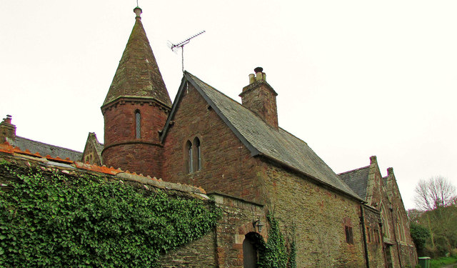
The grade II* listed house Link seen from Wilcove Lane. "School, (built shortly after 1847 by W.H. Pole Carew) rebuilt as vicarage for Church of St. Philip and St. James, remodelled by William White c. 1849 altered as 2 houses" - that's a lot that happened in a short time. According to Pevsner & Radcliffe (2nd ed, 1970), the name is "Merifield". See also SX4256 : Maryfield House.
 Map © Crown Copyright")
TIP: Click the map for more Large scale mapping
- Grid Square
- SX4256, 68 images (more nearby 🔍)
- Photographer
- Derek Harper (more nearby)
- Date Taken
- Saturday, 2 March, 2019 (more nearby)
- Submitted
- Saturday, 6 July, 2019
- Subject Location
-
OSGB36:
 SX 4235 5620 [10m precision]
WGS84: 50:23.0702N 4:13.1329W - Camera Location
-
OSGB36: SX 4235 5621
- View Direction
- SOUTH (about 180 degrees)