2019
NJ2418 : Ruins at Wester Scalan
taken 5 years ago, near to Chapeltown, Moray, Scotland
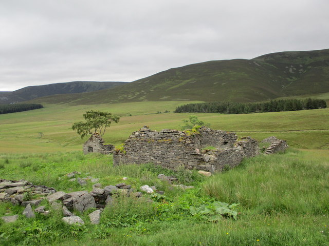
Ruins at Wester Scalan
A ruined farm in the upper Braes of Glenlivet, at the foot of the Ladder Hills.
The name Scalan derives from the Gaelic 'sgolan' - a rough shelter.
The name Scalan derives from the Gaelic 'sgolan' - a rough shelter.
 Map © Crown Copyright")
TIP: Click the map for more Large scale mapping
- Grid Square
- NJ2418, 10 images (more nearby 🔍)
- Photographer
- Alan O'Dowd (more nearby)
- Date Taken
- Wednesday, 3 July, 2019 (more nearby)
- Submitted
- Tuesday, 9 July, 2019
- Subject Location
-
OSGB36:
 NJ 2424 1895 [10m precision]
WGS84: 57:15.2957N 3:15.4420W - Camera Location
-
OSGB36: NJ 2424 1894
- View Direction
- NORTH (about 0 degrees)