2019
J3246 : Path, Drumkeeragh Forest
taken 5 years ago, 4 km ESE of Finnis, Co Down, Northern Ireland
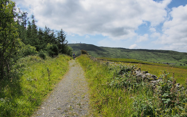
Path, Drumkeeragh Forest
Path on the north-western edge of Drumkeeragh Forest with fields on the other side of the dry stone wall; Slieve Croob is beyond.
Drumkeeragh forest near Dromara
Drumkeeragh forest is a commercial forest of about 500 acres, owned by the NI Forestry Service, to the north east of Slieve Croob J3145 : Slieve Croob on the eastern side of the Dromara Castlewellan Road. There are no amenities except paths and an unsurfaced car park.
Loading map... (JavaScript required)
- Grid Square
- J3246, 33 images (more nearby 🔍)
- Photographer
- Rossographer (more nearby)
- Date Taken
- Sunday, 7 July, 2019 (more nearby)
- Submitted
- Wednesday, 10 July, 2019
- Subject Location
-
Irish:
 J 328 466 [100m precision]
WGS84: 54:21.0738N 5:57.4340W - Camera Location
-
Irish: J 329 467
- View Direction
- Southwest (about 225 degrees)