2019
SU7512 : Back Lane
taken 5 years ago, near to Forestside, West Sussex, England
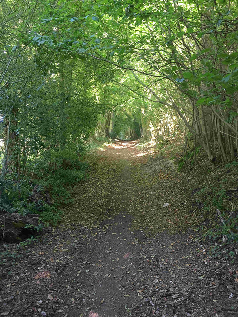
Back Lane
Back Lane, a minor unsealed road which runs parallel to, but presumably predates, Diddybones Nap, the road through Forestside to the south.
 Map © Crown Copyright")
TIP: Click the map for more Large scale mapping
- Grid Square
- SU7512, 74 images (more nearby 🔍)
- Photographer
- Hugh Craddock (more nearby)
- Date Taken
- Friday, 12 July, 2019 (more nearby)
- Submitted
- Saturday, 13 July, 2019
- Subject Location
-
OSGB36:
 SU 7528 1279 [10m precision]
WGS84: 50:54.5808N 0:55.8383W - Camera Location
-
OSGB36: SU 7523 1278
- View Direction
- East-northeast (about 67 degrees)