2019
SN6962 : Former railway course north-east of Tregaron in Ceredigion
taken 5 years ago, 3 km from Swyddffynnon, Ceredigion/Sir Ceredigion, Wales
This is 1 of 2 images, with title Former railway course north-east of Tregaron in Ceredigion in this square
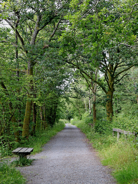
Former railway course north-east of Tregaron in Ceredigion
Looking north-east towards Pontrhydfendigaid, this cycle route and footpath follows the course of the former Manchester and Milford Railway (which went to neither place) and closed in 1965. The B4343 road is adjacent (off to the right).
 Map © Crown Copyright")
TIP: Click the map for more Large scale mapping
- Grid Square
- SN6962, 85 images (more nearby 🔍)
- Photographer
- Roger D Kidd (more nearby)
- Date Taken
- Monday, 8 July, 2019 (more nearby)
- Submitted
- Sunday, 14 July, 2019
- Subject Location
-
OSGB36:
 SN 6937 6285 [10m precision]
WGS84: 52:14.8967N 3:54.8929W - Camera Location
-
OSGB36: SN 6934 6278
- View Direction
- North-northeast (about 22 degrees)