2019
SO0617 : Step Down Stream
taken 5 years ago, near to Abercynafon, Powys, Wales
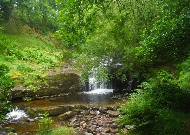
Step Down Stream
One of the waterfalls in the River Caerfanell valley, taken from the east bank.
A public footpath runs beyond a fence, on the west bank, linking two car parks. With kissing gates, stiles at certain points, and a footbridge across it.
This waterfall is in the wooded section, others exists up in the more open area.
From where the river originates flows down the valley to the Talybont Reservoir
 Map © Crown Copyright")
TIP: Click the map for more Large scale mapping
- Grid Square
- SO0617, 49 images (more nearby 🔍)
- Photographer
- D M Wilmot (more nearby)
- Date Taken
- Saturday, 20 July, 2019 (more nearby)
- Submitted
- Sunday, 21 July, 2019
- Subject Location
-
OSGB36:
 SO 0601 1731 [10m precision]
WGS84: 51:50.7869N 3:21.9504W - Camera Location
-
OSGB36: SO 0601 1731
- View Direction
- North-northwest (about 337 degrees)