2019
NZ2742 : Looking east along Claypath
taken 5 years ago, near to Durham, County Durham, England
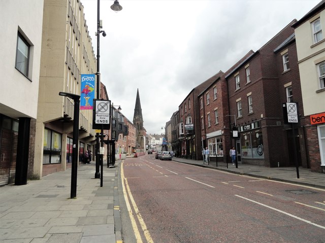
Looking east along Claypath
Viewed from near the west end of the street, which runs from the bottom of the marketplace in Durham City. This is one of the old medieval streets, although most of the buildings here are more recent. The church spire is Christchurch, formerly the United Reformed Church of 1886.
 Map © Crown Copyright")
TIP: Click the map for more Large scale mapping
- Grid Square
- NZ2742, 1485 images (more nearby 🔍)
- Photographer
- Robert Graham (more nearby)
- Date Taken
- Friday, 12 July, 2019 (more nearby)
- Submitted
- Friday, 9 August, 2019
- Subject Location
-
OSGB36:
 NZ 2751 4264 [10m precision]
WGS84: 54:46.6754N 1:34.4303W - Camera Location
-
OSGB36: NZ 2746 4262
- View Direction
- East-northeast (about 67 degrees)