2019
NZ1962 : Road bridge over former railway path near Swalwell Bridge
taken 5 years ago, near to Whickham, Gateshead, England
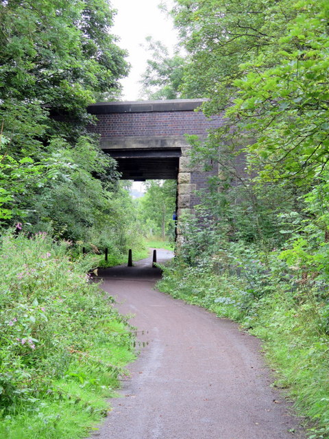
Road bridge over former railway path near Swalwell Bridge
The Swalwell or New Derwent Bridge dates from 1927. It carries the B6317 (Hexham Road) over the River Derwent.
"Underneath the bridge, on the north side, once ran the old 'Main Way', the railway carrying coal and coke to the staiths at Derwenthaugh, and the bridge was built with a sufficient span to accommodate this railway which closed in 1985 and is now a footpath and cycle track."
Link
"Underneath the bridge, on the north side, once ran the old 'Main Way', the railway carrying coal and coke to the staiths at Derwenthaugh, and the bridge was built with a sufficient span to accommodate this railway which closed in 1985 and is now a footpath and cycle track."
Link
 Map © Crown Copyright")
TIP: Click the map for more Large scale mapping
- Grid Square
- NZ1962, 68 images (more nearby 🔍)
- Photographer
- Andrew Curtis (more nearby)
- Date Taken
- Sunday, 11 August, 2019 (more nearby)
- Submitted
- Sunday, 11 August, 2019
- Subject Location
-
OSGB36:
 NZ 1978 6233 [10m precision]
WGS84: 54:57.3135N 1:41.5601W - Camera Location
-
OSGB36: NZ 19756 62299
- View Direction
- Northeast (about 45 degrees)