2019
TQ1148 : Cattle on the path, near Dorking
taken 5 years ago, near to Wotton, Surrey, England
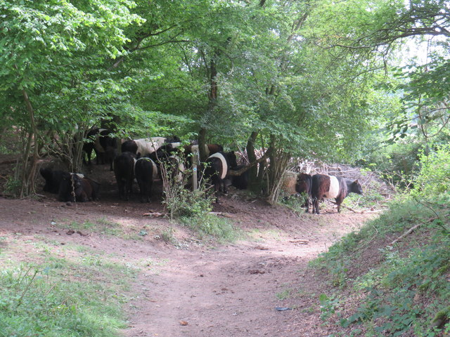
Cattle on the path, near Dorking
Cattle on a public bridleway near Dorking.
North Downs
The North Downs are a ridge of chalk hills in south east England that stretch for 120 miles (190 km) from Farnham in Surrey to the White Cliffs of Dover in Kent. The North Downs lie within two Areas of Outstanding Natural Beauty (AONBs), the Surrey Hills and the Kent Downs. The North Downs Way National Trail runs along the North Downs from Farnham to Dover.
At its highest point, Botley Hill in Surrey is 882ft above sea level.
Extract from Wikipedia Link
 Map © Crown Copyright")
TIP: Click the map for more Large scale mapping
- Grid Square
- TQ1148, 84 images (more nearby 🔍)
- Photographer
- Malc McDonald (more nearby)
- Date Taken
- Sunday, 28 July, 2019 (more nearby)
- Submitted
- Friday, 16 August, 2019
- Subject Location
-
OSGB36:
 TQ 1188 4884 [10m precision]
WGS84: 51:13.6677N 0:23.9462W - Camera Location
-
OSGB36: TQ 1186 4884
- View Direction
- East-southeast (about 112 degrees)