2019
TF4730 : Path along the sea wall of The Wash
taken 5 years ago, near to Gedney Drove End, Lincolnshire, England
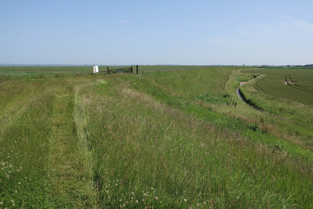
Path along the sea wall of The Wash
With reclaimed land to the right and the remaining saltmarsh to the left.
 Map © Crown Copyright")
TIP: Click the map for more Large scale mapping
- Grid Square
- TF4730, 15 images (more nearby 🔍)
- Photographer
- Hugh Venables (more nearby)
- Date Taken
- Saturday, 29 June, 2019 (more nearby)
- Submitted
- Saturday, 24 August, 2019
- Subject Location
-
OSGB36:
 TF 4703 3016 [10m precision]
WGS84: 52:50.9324N 0:10.9133E - Camera Location
-
OSGB36: TF 47021 30181
- View Direction
- South-southeast (about 157 degrees)