2019
SJ8557 : South Cheshire Way
taken 5 years ago, near to Mow Cop, Staffordshire, England
South Cheshire Way
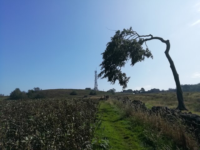
Windblown tree and fields of ripe rapeseed beside the South Cheshire Way with the Mow Cop radio transmitter in the background. The South Cheshire Way is a long-distance footpath which runs for 34 miles from its starting point at the Llangollen branch of the Shropshire Union Canal at Grindley Brook to Mow Cop.
 Map © Crown Copyright")
TIP: Click the map for more Large scale mapping
- Grid Square
- SJ8557, 126 images (more nearby 🔍)
- Photographer
- Sue Adair (more nearby)
- Date Taken
- Monday, 26 August, 2019 (more nearby)
- Submitted
- Monday, 9 September, 2019
- Subject Location
-
OSGB36:
 SJ 8589 5778 [10m precision]
WGS84: 53:7.0206N 2:12.7361W - Camera Location
-
OSGB36: SJ 8577 5792
- View Direction
- Southeast (about 135 degrees)