2019
NZ2350 : Looking up Beechgrove Lane
taken 5 years ago, near to Edmondsley, County Durham, England
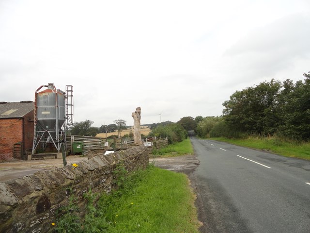
Looking up Beechgrove Lane
View north up the lane from beside Beech Grove Farm. The farm buildings are on the left. The farmhouse is an early Victorian country house and is behind the modern buildings, but is visible from higher up the lane, see NZ2250 : Beech Grove farmhouse
 Map © Crown Copyright")
TIP: Click the map for more Large scale mapping
- Grid Square
- NZ2350, 11 images (more nearby 🔍)
- Photographer
- Robert Graham (more nearby)
- Date Taken
- Monday, 9 September, 2019 (more nearby)
- Submitted
- Tuesday, 17 September, 2019
- Subject Location
-
OSGB36:
 NZ 2302 5017 [10m precision]
WGS84: 54:50.7489N 1:38.5827W - Camera Location
-
OSGB36: NZ 2305 5008
- View Direction
- North-northwest (about 337 degrees)