SO9525 : Gloucestershire Warwickshire Steam Railway Signal Box at Cheltenham Race Course Station
taken 5 years ago, near to Southam, Gloucestershire, England
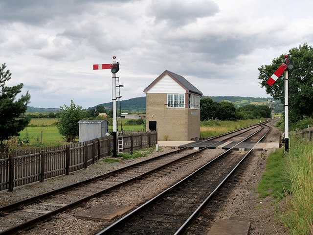
The Gloucestershire Warwickshire Steam Railway (GWR or GWSR) is a heritage railway which runs along the Gloucestershire/Worcestershire border.
The GWSR has restored and reopened around 14 miles of track, operating between Cheltenham Racecourse and Broadway. The line was originally part of the Great Western Railway's Cheltenham/Stratford-upon-Avon/Birmingham line, known as the Honeybourne Line, which was built in 19001906. The line runs through the Cotswold towns of Winchcombe and Bishop's Cleeve. The line was run down over the years and finally closed in 1976, with the double track being lifted from 1979.
The heritage group began steam train operations at Toddington in 1984 over 700 yards (640 m) of re-laid track. In 1987 the line was restored as far as Winchcombe. The railway continued to re-lay track west of Winchcombe, through the 693-yard long Greet Tunnel, and past the villages of Gretton, Gotherington and Bishops Cleeve. The line to Cheltenham Racecourse was re-opened by Princess Anne in 2003 and the latest extension of the line, to Broadway, opened in March 2018.
 Map © Crown Copyright")
- Grid Square
- SO9525, 107 images (more nearby 🔍)
- Photographer
- David Dixon (more nearby)
- Date Taken
- Sunday, 28 July, 2019 (more nearby)
- Submitted
- Friday, 20 September, 2019
- Subject Location
-
OSGB36:
 SO 955 252 [100m precision]
WGS84: 51:55.5180N 2:3.9584W - Camera Location
-
OSGB36: SO 955 251
- View Direction
- Northeast (about 45 degrees)