2019
NZ2150 : View down Lowery Lane, Craghead
taken 5 years ago, near to Craghead, County Durham, England
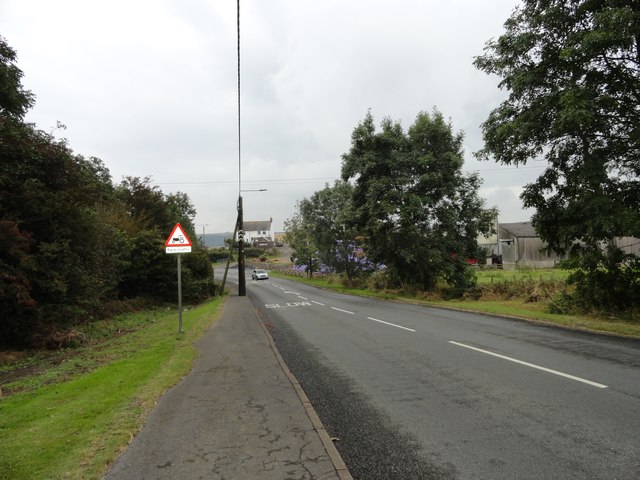
View down Lowery Lane, Craghead
This is the road into the village from the south, and the main route to Durham city from here. The house at the bottom of the bank is White House Farm.
 Map © Crown Copyright")
TIP: Click the map for more Large scale mapping
- Grid Square
- NZ2150, 26 images (more nearby 🔍)
- Photographer
- Robert Graham (more nearby)
- Date Taken
- Monday, 9 September, 2019 (more nearby)
- Submitted
- Wednesday, 25 September, 2019
- Subject Location
-
OSGB36:
 NZ 2159 5051 [10m precision]
WGS84: 54:50.9360N 1:39.9173W - Camera Location
-
OSGB36: NZ 2155 5069
- View Direction
- South-southeast (about 157 degrees)