2019
NZ9011 : Henrietta Street, Whitby
taken 5 years ago, near to Whitby, North Yorkshire, England
This is 1 of 14 images, with title Henrietta Street, Whitby in this square
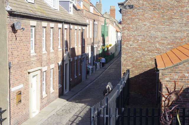
Henrietta Street, Whitby
Seen here from the foot of the Abbey Steps, cobbled Henrietta Street's cottages look tidy and well-maintained. But the street has a colourful history, at one time associated with smuggling and prostitution. It was called Haggerlythe until 1761 when it was renamed by Nathanial Cholmley who rebuilt the cottages in the hope of creating a street of desirable dwellings. This dream was never properly realised and in 1786 there was a large landslide and a great part of the Street disappeared; although it was subsequently rebuilt there were other landslides, the last of which was in 1923. Legend has it that there are still barrels of smuggled beer and rum entombed in the cliff face by the landslides.
 Map © Crown Copyright")
TIP: Click the map for more Large scale mapping
- Grid Square
- NZ9011, 1285 images (more nearby 🔍)
- Photographer
- Stephen McKay (more nearby)
- Date Taken
- Saturday, 21 September, 2019 (more nearby)
- Submitted
- Thursday, 26 September, 2019
- Subject Location
-
OSGB36:
 NZ 9005 1132 [10m precision]
WGS84: 54:29.3542N 0:36.6832W - Camera Location
-
OSGB36: NZ 9004 1130
- View Direction
- North-northeast (about 22 degrees)