2019
J1460 : Building at Moira Demesne Park
taken 5 years ago, near to Moira, Co Down, Northern Ireland
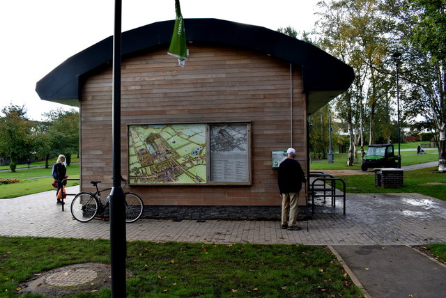
Building at Moira Demesne Park
The large map on the wall shows an artists impression of how the area looked like when the estate buildings. There was a spell of drought which revealed what was under the ground in July 2018 Link
Loading map... (JavaScript required)
- Grid Square
- J1460, 84 images (more nearby 🔍)
- Photographer
- Kenneth Allen (more nearby)
- Date Taken
- Sunday, 29 September, 2019 (more nearby)
- Submitted
- Monday, 30 September, 2019
- Subject Location
-
Irish:
 J 149 607 [100m precision]
WGS84: 54:28.9262N 6:13.6615W - Camera Location
-
Irish: J 149 607
- View Direction
- West-southwest (about 247 degrees)