2019
TM4357 : Dead trees at the edge of Hazlewood Marshes
taken 5 years ago, 3 km from Coldfair Green, Suffolk, England
This is 1 of 3 images, with title Dead trees at the edge of Hazlewood Marshes in this square
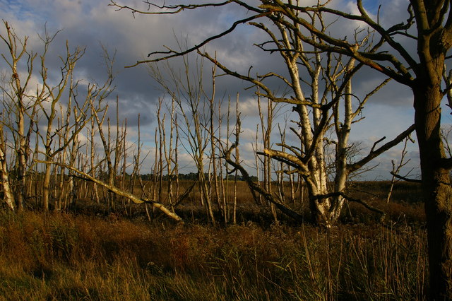
Dead trees at the edge of Hazlewood Marshes
Hazlewood Marshes, an area of undrained freshwater grazing marsh on the north side of the Alde estuary, was acquired by Suffolk Wildlife Trust in the early 1990s. The area was transformed dramatically in early December 2013, when the river wall was breached by a high tide: the area is now flooded twice daily and is in the process of transition to salt marsh, the trees that formerly stood on its fringes now poisoned by salt water.
See other images of Hazlewood Marshes, Suffolk
See other images of Hazlewood Marshes, Suffolk
 Map © Crown Copyright")
TIP: Click the map for more Large scale mapping
- Grid Square
- TM4357, 22 images (more nearby 🔍)
- Photographer
- Christopher Hilton (more nearby)
- Date Taken
- Saturday, 5 October, 2019 (more nearby)
- Submitted
- Sunday, 6 October, 2019
- Subject Location
-
OSGB36:
 TM 4344 5799 [10m precision]
WGS84: 52:9.9866N 1:33.5001E - Camera Location
-
OSGB36: TM 4343 5801
- View Direction
- South-southeast (about 157 degrees)