2019
NU0800 : Cragend
taken 5 years ago, near to Pauperhaugh, Northumberland, England
This is 1 of 2 images, with title Cragend in this square
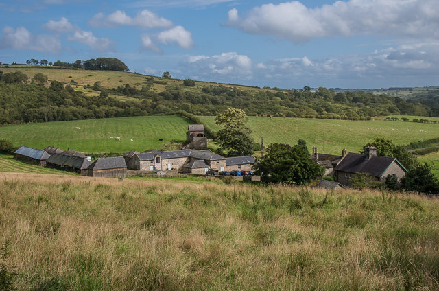
Cragend
Farm originally part of the Cragside Estate. The building just beyond the main farm is an experimental hydraulic silo, designed by William Armstrong in c.1895. Grade II* listed - see Link .
.
 Map © Crown Copyright")
TIP: Click the map for more Large scale mapping
- Grid Square
- NU0800, 55 images (more nearby 🔍)
- Photographer
- Ian Capper (more nearby)
- Date Taken
- Sunday, 18 August, 2019 (more nearby)
- Submitted
- Monday, 14 October, 2019
- Subject Location
-
OSGB36:
 NU 086 009 [100m precision]
WGS84: 55:18.1303N 1:51.9002W - Camera Location
-
OSGB36: NU 085 009
- View Direction
- East-southeast (about 112 degrees)