2019
R1126 : Main Street, Abbeyfeale
taken 5 years ago, near to Abbeyfeale, Co Limerick, Ireland
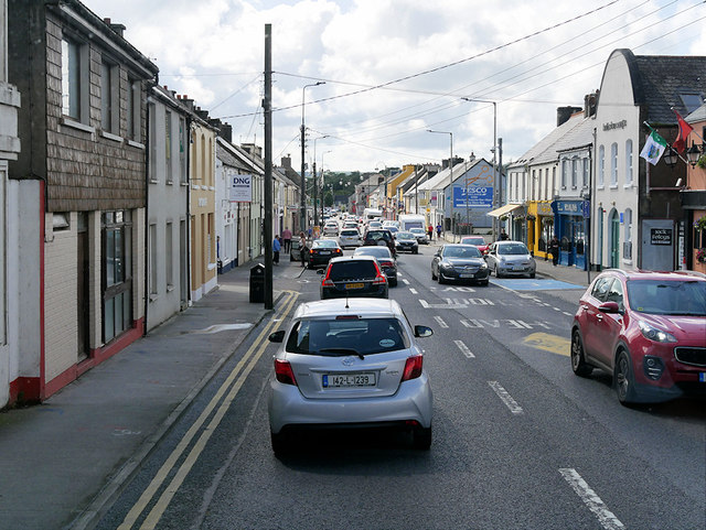
Main Street, Abbeyfeale
Abbeyfeale (Irish: Mainistir na Féile, meaning "Abbey of the Feale") is a historic market town in County Limerick near the boundary with County Kerry in the south-west of Ireland. The town is situated on the banks of the River Feale in the foothills of the Mullaghareirk Mountains, some 21 kilometres south of Newcastle West on the N21; the main road from Limerick to Tralee.
Irish National Primary Road N21
The N21 road is a national primary road in Ireland. The route runs for 84 km from the M20 outside Limerick to Tralee in County Kerry, running through the towns of Abbeyfeale, Newcastlewest, Adare and the village of Templeglantine.
Loading map... (JavaScript required)
- Grid Square
- R1126, 9 images (more nearby 🔍)
- Photographer
- David Dixon (more nearby)
- Date Taken
- Monday, 12 August, 2019 (more nearby)
- Submitted
- Tuesday, 12 November, 2019
- Subject Location
-
Irish:
 R 116 267 [100m precision]
WGS84: 52:23.1529N 9:17.8914W - Camera Location
-
Irish: R 117 268
- View Direction
- West-southwest (about 247 degrees)