SH8678 : Millennium milepost along the Wales Coast Path
taken 5 years ago, near to Old Colwyn, Conwy, Wales
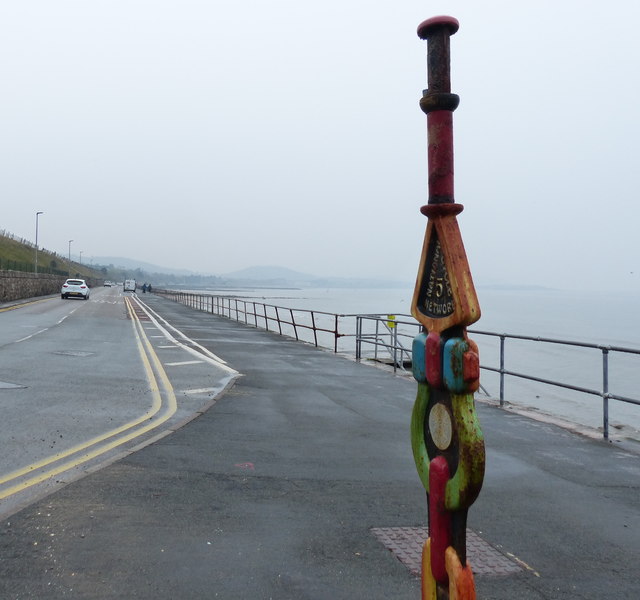
The Wales Coast Path (Welsh: Llwybr Arfordir Cymru) is a long distance footpath which follows the whole of the coastline of Wales. It opened on 5 May 2012, and offers a 870 mile long route from Chepstow in the south to Queensferry in the north.
Wales is the first country in the world to provide a dedicated footpath along its entire coastline. The Path runs through eleven National Nature Reserves and other nature reserves, including those managed by The Wildlife Trusts or Royal Society for the Protection of Birds (RSPB).
Logo can be seen atSS0897 : Logo, Wales Coast Path.
Website: Link
National Route 5 of the National Cycle Network is a long distance route which when complete will connect Reading and Holyhead via Oxford, Banbury, Stratford-upon-Avon, Redditch, Bromsgrove, Birmingham, Walsall, Stafford, Stoke-on-Trent, Chester, Colwyn Bay and Bangor. The southern half of the route between Reading and Walsall is open and signed whilst the northern half between Walsall and Holyhead is still under development.
 Map © Crown Copyright")
- Grid Square
- SH8678, 159 images (more nearby 🔍)
- Photographer
- Mat Fascione (more nearby)
- Date Taken
- Tuesday, 16 April, 2019 (more nearby)
- Submitted
- Thursday, 28 November, 2019
- Subject Location
-
OSGB36:
 SH 869 787 [100m precision]
WGS84: 53:17.5901N 3:41.8248W - Camera Location
-
OSGB36: SH 869 787
- View Direction
- West-northwest (about 292 degrees)