2019
SO2686 : Offa's Dyke Path approaching Middle Knuck
taken 5 years ago, near to Mainstone, Shropshire, England
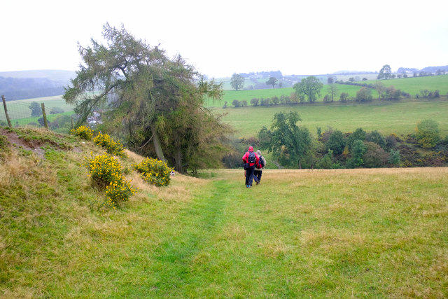
Offa's Dyke Path approaching Middle Knuck
Heading south along Offa's Dyke south of Churchtown towards Middle Knuck.
 Map © Crown Copyright")
TIP: Click the map for more Large scale mapping
- Grid Square
- SO2686, 15 images (more nearby 🔍)
- Photographer
- Jeff Buck (more nearby)
- Date Taken
- Monday, 14 October, 2019 (more nearby)
- Submitted
- Sunday, 8 December, 2019
- Subject Location
-
OSGB36:
 SO 260 866 [100m precision]
WGS84: 52:28.3546N 3:5.3800W - Camera Location
-
OSGB36: SO 261 866
- View Direction
- South-southwest (about 202 degrees)