2007
SU9744 : Lammas Lands
taken 16 years ago, near to Godalming, Surrey, England
This is 1 of 5 images, with title Lammas Lands in this square
Lammas Lands
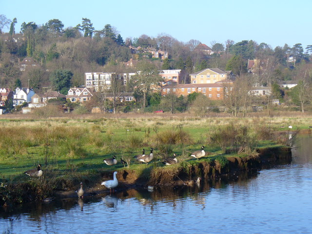
Flood meadow in Godalming, between the Wey (foreground) and Hell Ditch (distance, in front of the houses). The Lammas Lands were formerly common pasture. In the background is Frith Hill. Canada Geese are enjoying the winter sunshine.
Link
Link
 Map © Crown Copyright")
TIP: Click the map for more Large scale mapping
- Grid Square
- SU9744, 257 images (more nearby 🔍)
- Photographer
- Colin Smith (more nearby)
- Date Taken
- Sunday, 16 December, 2007 (more nearby)
- Submitted
- Sunday, 16 December, 2007
- Subject Location
-
OSGB36:
 SU 971 441 [100m precision]
WGS84: 51:11.2726N 0:36.6589W - Camera Location
-
OSGB36: SU 971 440
- View Direction
- North-northwest (about 337 degrees)