SK3991 : Tramtrain under trail
taken 5 years ago, near to Tinsley, Sheffield, England
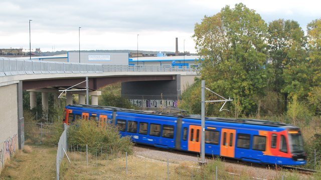
Supertrams run on three lines in Sheffield. The lines opened in 1994. The system is run by Stagecoach.
Wikipedia: Link
Website: Link
The River Don rises on the Pennines and flows 70 miles eastward to join the River Trent.
Wikipedia: Link
Meadowhall is an indoor shopping centre in Sheffield. It lies 3 miles north-east of Sheffield city centre and 2 miles from Rotherham town centre. It is the largest shopping centre in Yorkshire and the eighth largest in the United Kingdom.
The centre opened in 1990 and has over 280 shops.
Wikipedia: Link
The M1 is a northsouth motorway connecting London to Leeds, where it joins the A1(M) near Aberford. It was the first motorway to be completed in the United Kingdom.
The motorway is 193 miles long and was constructed in four phases. Most of the motorway was opened between 1959 and 1968 but the southern end was extended in 1977 and the northern end was extended in 1999.
 Map © Crown Copyright")
- Grid Square
- SK3991, 223 images (more nearby 🔍)
- Photographer
- Dave Pickersgill (more nearby)
- Date Taken
- Sunday, 21 October, 2018 (more nearby)
- Submitted
- Thursday, 26 December, 2019
- Subject Location
-
OSGB36:
 SK 397 910 [100m precision]
WGS84: 53:24.8862N 1:24.2416W - Camera Location
-
OSGB36: SK 396 910
- View Direction
- East-northeast (about 67 degrees)