SO8540 : Roadworks raising the A4104
taken 5 years ago, near to Upton Upon Severn, Worcestershire, England
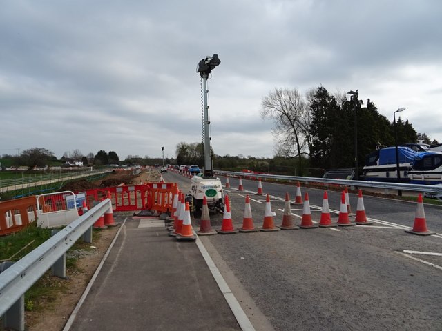
The A4104 near the marina to the east of Upton-upon-Severn is being raised by a metre to prevent it from flooding. Work is being carried out on a 530-metre stretch of the road, the work will also include widening and the improvement of drainage. The section of the road immediately to the east of the bridge crossing the River Severn was raised in 2003; this part of the road crosses a viaduct which had to be replaced at the time due to the previous viaduct having to be replaced due to a structural weakness. At the time there wasn't sufficient funding to raise the entire length of road crossing the floodplain. Initial work took place in October 2017 when some of the hedge beside the road was removed. Roadworks to raise the road level began at the end of January 2018. The work was carried out in three phases, the first phase in the winter of 2018 involved raising the road nearest Upton, the second phase in the spring of 2018 being to raise the road at the eastern, Ryall section of the road. Worked ceased through the summer, with the third phase beginning in the autumn of 2018. The third stage involved constructing a temporary parallel road to divert the traffic while the old road was removed and the new raised carriageway constructed. This part of the work also included laying large drainage pipes as the road crosses a watercourse.
 Map © Crown Copyright")
- Grid Square
- SO8540, 1237 images (more nearby 🔍)
- Photographer
- Philip Halling (more nearby)
- Date Taken
- Sunday, 31 March, 2019 (more nearby)
- Submitted
- Saturday, 28 December, 2019
- Subject Location
-
OSGB36:
 SO 8553 4089 [10m precision]
WGS84: 52:3.9714N 2:12.7498W - Camera Location
-
OSGB36: SO 8546 4088
- View Direction
- EAST (about 90 degrees)