2020
SX7478 : Fence near Hound Tor
taken 4 years ago, 3 km from Manaton, Devon, England
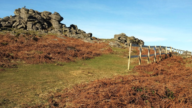
Fence near Hound Tor
The fence discourages visitors from reaching an area that has been subject to undue erosion. This is part of the scheduled monument of Prehistoric and medieval settlements and their field systems at Hound Tor Link . A figure has appeared on top of the tor SX7478 : Hound Tor.
 Map © Crown Copyright")
TIP: Click the map for more Large scale mapping
- Grid Square
- SX7478, 161 images (more nearby 🔍)
- Photographer
- Derek Harper (more nearby)
- Date Taken
- Monday, 20 January, 2020 (more nearby)
- Submitted
- Monday, 27 January, 2020
- Subject Location
-
OSGB36:
 SX 7434 7888 [10m precision]
WGS84: 50:35.7648N 3:46.6078W - Camera Location
-
OSGB36: SX 7435 7887
- View Direction
- Northwest (about 315 degrees)