2020
SH7476 : Murddyn ruins
taken 4 years ago, near to Capelulo, Conwy, Wales
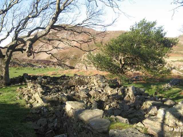
Murddyn ruins
The leafless winter tree allows a view of the ruins of the farmstead given as Murddyn on the OS map of 1888. Just about the only level plot for a considerable distance has been occupied on the edge of the uplands, and a small stream for a water supply descends a short distance to the southwest.
 Map © Crown Copyright")
TIP: Click the map for more Large scale mapping
- Grid Square
- SH7476, 84 images (more nearby 🔍)
- Photographer
- Jonathan Wilkins (more nearby)
- Date Taken
- Thursday, 6 February, 2020 (more nearby)
- Submitted
- Thursday, 6 February, 2020
- Subject Location
-
OSGB36:
 SH 7493 7692 [10m precision]
WGS84: 53:16.4681N 3:52.6237W - Camera Location
-
OSGB36: SH 7494 7691
- View Direction
- Northwest (about 315 degrees)