2020
J3576 : The 'Keewhit' at Belfast
taken 4 years ago, 3 km from Belfast, Co Antrim, Northern Ireland
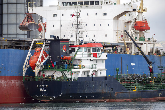
The 'Keewhit' at Belfast
The bunkering tanker 'Keewhit' Link alongside the 'Fortune Sunny' J3576 : The 'Fortune Sunny' at Belfast but preparing to depart - note the crewman on the crane and movement at the stern (gathering seabirds are a good indicator as propellers churn up the water creating the possibility of a snack rising to the surface).
Stormont Wharf, Belfast
Wharf at the Victoria Channel, Belfast docks. The wharf was constructed 1956-62 by Charles Brand & Son, to provide a total lineal quayage of 580 metres; this was further extended by an additional 250 metres which was completed in 2009. Stormont Wharf is now one of the longest deep water quays in Ireland.
Loading map... (JavaScript required)
- Grid Square
- J3576, 974 images (more nearby 🔍)
- Photographer
- Rossographer (more nearby)
- Date Taken
- Thursday, 6 February, 2020 (more nearby)
- Submitted
- Friday, 7 February, 2020
- Subject Location
-
Irish:
 J 353 761 [100m precision]
WGS84: 54:36.9194N 5:54.3469W - Camera Location
-
Irish: J 353 758
- View Direction
- NORTH (about 0 degrees)