2013
TQ4179 : The Thames Barrier
taken 10 years ago, near to London City Airport, Newham, England
This is 1 of 35 images, with title The Thames Barrier in this square
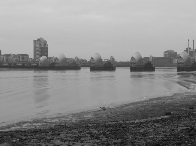
The Thames Barrier
The Thames Barrier is one of the largest movable flood barriers in the world. The Environment Agency runs and maintains the Thames Barrier as well as the capitals other flood defences.
The barrier spans 520 metres across the River Thames near Woolwich, and it protects 125 square kilometres of central London from flooding caused by tidal surges.
It became operational in 1982 and has 10 steel gates that can be raised into position across the River Thames. When raised, the main gates stand as high as a five-storey building and as wide as the opening of Tower Bridge. Each main gate weighs 3,300 tonnes.
Link
See other images of Thames Barrier
 Map © Crown Copyright")
TIP: Click the map for more Large scale mapping
- Grid Square
- TQ4179, 520 images (more nearby 🔍)
- Photographer
- Eirian Evans (more nearby)
- Date Taken
- Thursday, 28 November, 2013 (more nearby)
- Submitted
- Wednesday, 4 March, 2020
- Subject Location
-
OSGB36:
 TQ 415 795 [100m precision]
WGS84: 51:29.8256N 0:2.2400E - Camera Location
-
OSGB36: TQ 410 791
- View Direction
- Northeast (about 45 degrees)