2020
NU2421 : Dunstan Square Lime Kiln (ruin)
taken 4 years ago, near to Dunstan, Northumberland, England
This is 1 of 2 images, with title Dunstan Square Lime Kiln (ruin) in this square
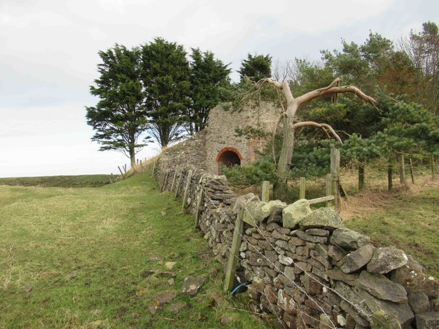
Dunstan Square Lime Kiln (ruin)
The remains of an estate lime kiln stand near quarries north of Dunstan Square. In the 1970s it was recorded as still intact with an arch measuring 8 feet (2.4m) high. It originally had four brick draw arches and two pots
Link (Archive Link )
Link
 Map © Crown Copyright")
TIP: Click the map for more Large scale mapping
- Grid Square
- NU2421, 73 images (more nearby 🔍)
- Photographer
- Les Hull (more nearby)
- Date Taken
- Wednesday, 4 March, 2020 (more nearby)
- Submitted
- Monday, 9 March, 2020
- Subject Location
-
OSGB36:
 NU 2475 2129 [10m precision]
WGS84: 55:29.0878N 1:36.5952W - Camera Location
-
OSGB36: NU 2473 2129
- View Direction
- EAST (about 90 degrees)