2020
SX7882 : Boulder-strewn fields near East Wray
taken 4 years ago, near to Lustleigh, Devon, England
This is 1 of 2 images, with title Boulder-strewn fields near East Wray in this square
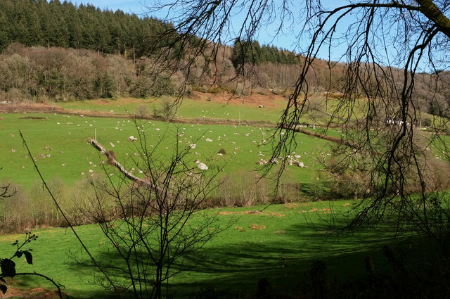
Boulder-strewn fields near East Wray
Another view of the area shown in SX7882 : East Wrey Barton from where SX7882 : East Wrey Barton was taken, looking right. The wood is East Wray Cleave.
 Map © Crown Copyright")
TIP: Click the map for more Large scale mapping
- Grid Square
- SX7882, 50 images (more nearby 🔍)
- Photographer
- Derek Harper (more nearby)
- Date Taken
- Monday, 16 March, 2020 (more nearby)
- Submitted
- Sunday, 22 March, 2020
- Subject Location
-
OSGB36:
 SX 7823 8262 [10m precision]
WGS84: 50:37.8314N 3:43.3854W - Camera Location
-
OSGB36: SX 7804 8255
- View Direction
- East-northeast (about 67 degrees)