2007
TQ1551 : Westhumble Chapel
taken 17 years ago, near to Westhumble, Surrey, England
This is 1 of 4 images, with title Westhumble Chapel in this square
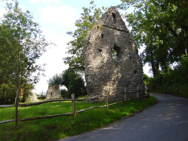
Westhumble Chapel
Ruins of 12th century Westhumble Chapel. Now cared for by the National Trust and on the route of London Green Belt Way. To read National Trust notice see Link
 Map © Crown Copyright")
TIP: Click the map for more Large scale mapping
- Grid Square
- TQ1551, 63 images (more nearby 🔍)
- Photographer
- Sean Davis (more nearby)
- Date Taken
- Thursday, 28 June, 2007 (more nearby)
- Submitted
- Saturday, 4 April, 2020
- Subject Location
-
OSGB36:
 TQ 15991 51940 [1m precision]
WGS84: 51:15.2903N 0:20.3551W - Camera Location
-
OSGB36: TQ 15974 51958
- View Direction
- Southeast (about 135 degrees)