2018
NC2871 : Cape Wrath: view towards Stack Clò Kearvaig
taken 6 years ago, near to Kearvaig, Highland, Scotland
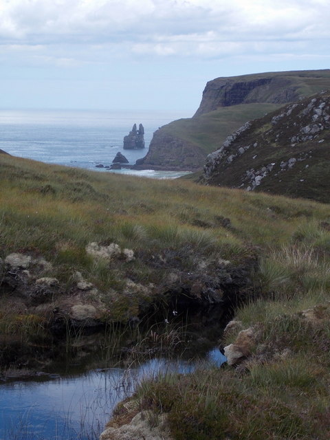
Cape Wrath: view towards Stack Clò Kearvaig
The journey to Cape Wrath, the northwest tip of mainland Britain, is not a straightforward one. It involves firstly the ferry across the Kyle of Durness, and then an 11-mile minibus ride on a dirt track across desolate military ranges.
On the return journey, the minibus stops at this point to admire the view towards the shapely offshore rock in the distance, Stack Clò Kearvaig. The rock is nicknamed the cathedral, for the obvious reason of its shape. See NC2973 : Cape Wrath: Stack Clò Kearvaig [sic] for a closer view from the same spot.
On the return journey, the minibus stops at this point to admire the view towards the shapely offshore rock in the distance, Stack Clò Kearvaig. The rock is nicknamed the cathedral, for the obvious reason of its shape. See NC2973 : Cape Wrath: Stack Clò Kearvaig [sic] for a closer view from the same spot.
 Map © Crown Copyright")
TIP: Click the map for more Large scale mapping
- Grid Square
- NC2871, 26 images (more nearby 🔍)
- Photographer
- Chris Downer (more nearby)
- Date Taken
- Tuesday, 31 July, 2018 (more nearby)
- Submitted
- Sunday, 5 April, 2020
- Subject Location
-
OSGB36:
 NC 2846 7176 [10m precision]
WGS84: 58:35.9884N 4:57.2297W - Camera Location
-
OSGB36: NC 2846 7173
- View Direction
- NORTH (about 0 degrees)