2020
SE3976 : Remains of Topcliffe Lock
taken 4 years ago, near to Topcliffe, North Yorkshire, England
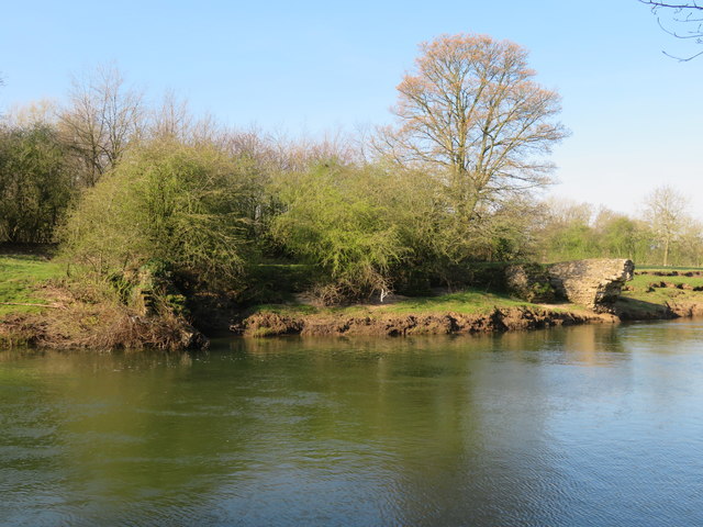
Remains of Topcliffe Lock
Just below the weir at Topcliffe Mill are the remains of a lock designed to by-pass the weir as part of the Swale Navigation, a scheme which planned to link the Ouse/Ure system and the Swale with navigable water as far as Bedale and Thirsk. Topcliffe lock was completed in 1767 and there is evidence that at least one craft passed through it, but the grand scheme ran out of money and no further locks were completed. Other evidence of locks and moorings exist downstream in SE4174, at Thirsk in SE4381 & 4382, at Leeming in SE2889 and at Bedale Harbour in SE2688.
 Map © Crown Copyright")
TIP: Click the map for more Large scale mapping
- Grid Square
- SE3976, 53 images (more nearby 🔍)
- Photographer
- Gordon Hatton (more nearby)
- Date Taken
- Sunday, 5 April, 2020 (more nearby)
- Submitted
- Tuesday, 7 April, 2020
- Subject Location
-
OSGB36:
 SE 3967 7629 [10m precision]
WGS84: 54:10.8518N 1:23.6210W - Camera Location
-
OSGB36: SE 3970 7632
- View Direction
- Southwest (about 225 degrees)