2020
SE1673 : Old Boundary Stone on Carle Moor
taken 4 years ago, 3 km from Greygarth, North Yorkshire, England
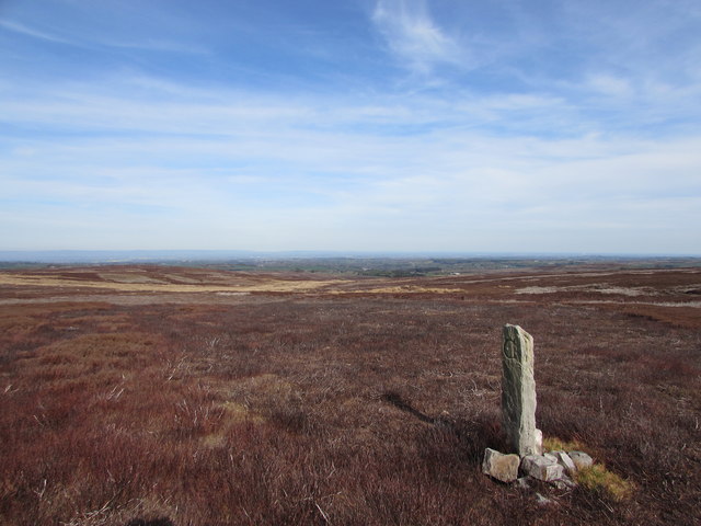
Old Boundary Stone on Carle Moor
It is carved C on the northside for Carlesmoor, and L on the southside for Laverton. It pre-dates the shooting lodge by at least 50 years.
 Map © Crown Copyright")
TIP: Click the map for more Large scale mapping
- Grid Square
- SE1673, 11 images (more nearby 🔍)
- Photographer
- Matthew Hatton (more nearby)
- Date Taken
- Thursday, 23 April, 2020 (more nearby)
- Submitted
- Thursday, 23 April, 2020
- Subject Location
-
OSGB36:
 SE 1644 7379 [10m precision]
WGS84: 54:9.5796N 1:44.9842W - Camera Location
-
OSGB36: SE 1641 7379
- View Direction
- EAST (about 90 degrees)