1990
NN9993 : Between Glen Luibeg and Corrour bothy
taken 34 years ago, near to Creagan Nan Gabhar [hill or Mountain], Aberdeenshire, Great Britain
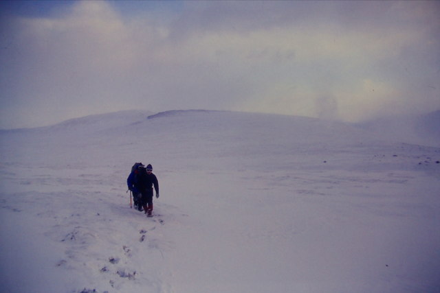
Between Glen Luibeg and Corrour bothy
As close as I can determine it, this appears to be the location of this photo, which was taken in deteriorating weather on the way to Corrour, and a walk the next day out to Aviemore. Whether we were actually on the path at this stage is very much a matter of conjecture, as it had long since vanished under the fresh snow.
 Map © Crown Copyright")
TIP: Click the map for more Large scale mapping
- Grid Square
- NN9993, 14 images (more nearby 🔍)
- Photographer
- Richard Law (more nearby)
- Date Taken
- Thursday, 1 March, 1990 (more nearby)
- Submitted
- Tuesday, 28 April, 2020
- Subject Location
-
OSGB36:
 NN 9944 9390 [10m precision]
WGS84: 57:1.5129N 3:39.4897W - Camera Location
-
OSGB36: NN 9935 9395
- View Direction
- East-southeast (about 112 degrees)