2013
NT2031 : Manor Water from Langhaugh
taken 11 years ago, near to Posso Craig [hill or Mountain], Scottish Borders, Great Britain
This is 1 of 5 images, with title starting with Manor in this square
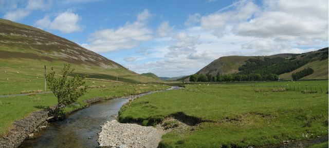
Manor Water from Langhaugh
View north up the Manor Water from Langhaugh farm bridge. Left is the slopes of Posso Craig; centre is Wood Hill and right is Horse Hope Craig.
 Map © Crown Copyright")
TIP: Click the map for more Large scale mapping
- Grid Square
- NT2031, 32 images (more nearby 🔍)
- Photographer
- david edwards (more nearby)
- Date Taken
- Sunday, 16 June, 2013 (more nearby)
- Submitted
- Saturday, 2 May, 2020
- Subject Location
-
OSGB36:
 NT 2031 3198 [10m precision]
WGS84: 55:34.4962N 3:15.9278W - Camera Location
-
OSGB36: NT 2007 3114
- View Direction
- North-northeast (about 22 degrees)