2019
SD8462 : Benchmark on stone in wall on southwest side of Black Gill Lane
taken 5 years ago, 3 km from Cleatop, North Yorkshire, England
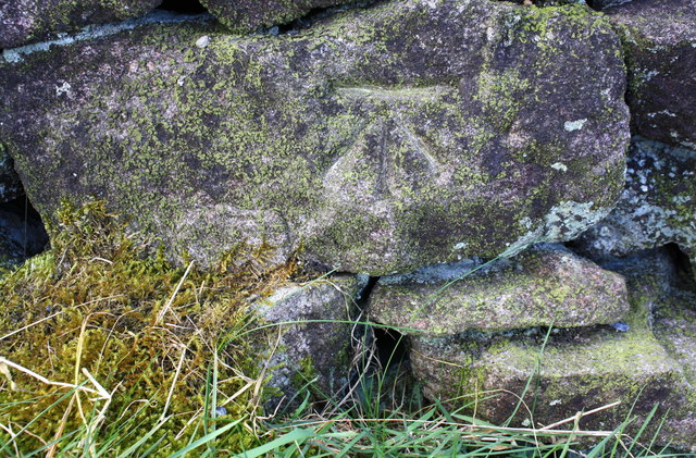
Benchmark on stone in wall on southwest side of Black Gill Lane
Ordnance Survey cut mark benchmark described on the Bench Mark Database at Link
 Map © Crown Copyright")
TIP: Click the map for more Large scale mapping
- Grid Square
- SD8462, 69 images (more nearby 🔍)
- Photographer
- Roger Templeman (more nearby)
- Contributed by
- Luke Shaw (more nearby)
- Date Taken
- Saturday, 6 April, 2019 (more nearby)
- Submitted
- Saturday, 2 May, 2020
- Subject Location
-
OSGB36:
 SD 8471 6224 [10m precision]
WGS84: 54:3.3530N 2:14.1034W - Camera Location
-
OSGB36: SD 8471 6224
- View Direction
- Southwest (about 225 degrees)