2020
SN1238 : Boundary stone by the A487
taken 4 years ago, near to Crosswell, Pembrokeshire/Sir Benfro, Wales
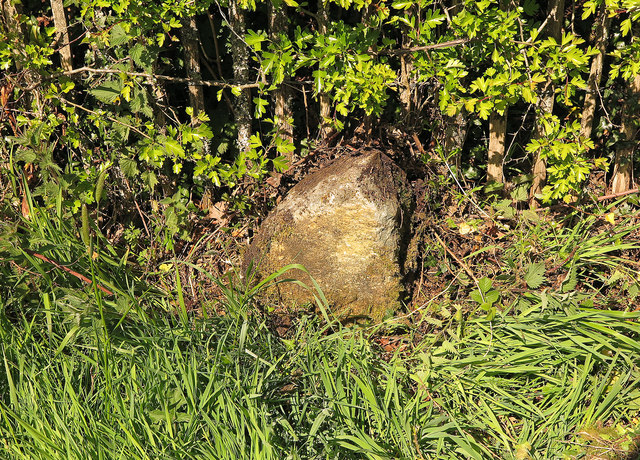
Boundary stone by the A487
This stone was shown as such on the 1888 and 1906 revisions of the OS maps, but not since. It marks the otherwise invisible boundary between the parishes of Eglwyswrw (right) and Meline (left). It also marks an eastern boundary of the Pembrokeshire Coast National Park; most of Eglwyswrw is outside the park.
The boundary here is typical of boundaries in the area; it follows a glacial meltwater channel running south to north. Small streams running southward and northward from this point mark the boundary. The road marks the high point along this line, hence the need for a stone.
The boundary here is typical of boundaries in the area; it follows a glacial meltwater channel running south to north. Small streams running southward and northward from this point mark the boundary. The road marks the high point along this line, hence the need for a stone.
 Map © Crown Copyright")
TIP: Click the map for more Large scale mapping
- Grid Square
- SN1238, 20 images (more nearby 🔍)
- Photographer
- Dylan Moore (more nearby)
- Date Taken
- Friday, 1 May, 2020 (more nearby)
- Submitted
- Monday, 4 May, 2020
- Subject Location
-
OSGB36:
 SN 12347 38111 [1m precision]
WGS84: 52:0.5773N 4:44.1372W - Camera Location
-
OSGB36: SN 12347 38109
- View Direction
- NORTH (about 0 degrees)