2020
SS7788 : Ordnance Survey Cut Mark
taken 4 years ago, near to Margam, Neath Port Talbot/Castell-Nedd Port Talbot, Wales
This is 1 of 5 images, with title Ordnance Survey Cut Mark in this square
Ordnance Survey Cut Mark
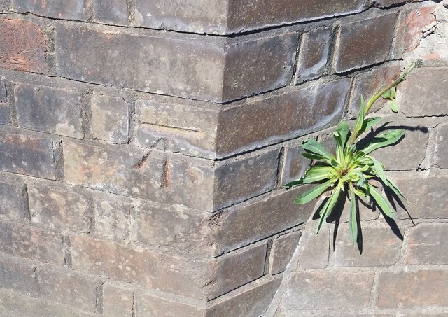
This OS cut mark can be found on north angle of the railway bridge. It marks a point 5.310m above mean sea level.
 Map © Crown Copyright")
TIP: Click the map for more Large scale mapping
- Grid Square
- SS7788, 115 images (more nearby 🔍)
- Photographer
- Adrian Dust (more nearby)
- Date Taken
- Wednesday, 6 May, 2020 (more nearby)
- Submitted
- Wednesday, 6 May, 2020
- Subject Location
-
OSGB36:
 SS 7749 8857 [10m precision]
WGS84: 51:34.9579N 3:46.1734W - Camera Location
-
OSGB36: SS 7749 8857
- View Direction
- Northwest (about 315 degrees)