1974
NX4977 : Steep slopes run out to Glenowrie
taken 50 years ago, 4 km WSW of Mid Garrary, Dumfries And Galloway, Scotland
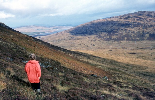
Steep slopes run out to Glenowrie
A pylon line follows the low ground. Most of the land in the middle distance is now densely forested. Some of the timber has already been harvested.
 Map © Crown Copyright")
TIP: Click the map for more Large scale mapping
- Grid Square
- NX4977, 6 images (more nearby 🔍)
- Photographer
- Alan Reid (more nearby)
- Date Taken
- October 1974 (more nearby)
- Submitted
- Saturday, 16 May, 2020
- Subject Location
-
OSGB36:
 NX 4943 7705 [10m precision]
WGS84: 55:3.9015N 4:21.5594W - Camera Location
-
OSGB36: NX 4905 7707
- View Direction
- EAST (about 90 degrees)