2020
TL4259 : The Eddington development, Cambridge - a blot on the landscape?
taken 4 years ago, near to Coton, Cambridgeshire, England
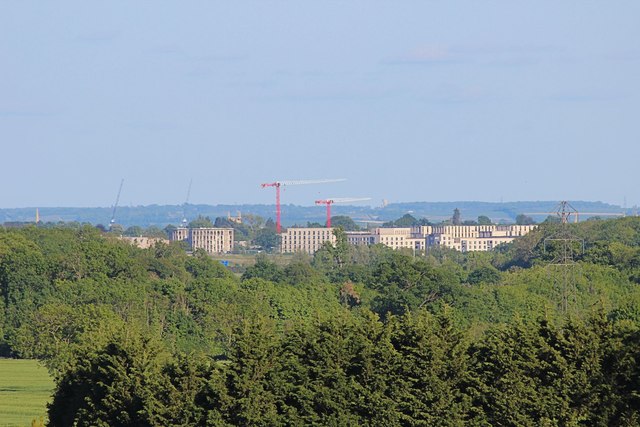
The Eddington development, Cambridge - a blot on the landscape?
A blot or not it is certainly obtrusive. This is the view from almost 3 miles away from the footpath near the end of Pettitt's lane, Dry Drayton. The good news is that in cloudy weather it doesn't stick out so much. The Eddington development ( Link ) is a £1bn development by the University of Cambridge primarily to provide homes for staff & students, with schooling & retail facilities. It is situated in the NW of the city on former green-belt land bounded by Madingley & Huntingdon Roads & the M11.
 Map © Crown Copyright")
TIP: Click the map for more Large scale mapping
- Grid Square
- TL4259, 210 images (more nearby 🔍)
- Photographer
- Martin Tester (more nearby)
- Date Taken
- Thursday, 14 May, 2020 (more nearby)
- Submitted
- Monday, 18 May, 2020
- Subject Location
-
OSGB36:
 TL 4255 5990 [10m precision]
WGS84: 52:13.1324N 0:5.1171E - Camera Location
-
OSGB36: TL 3829 6254
- View Direction
- East-southeast (about 112 degrees)