2019
SE1502 : Old Bridge Marker near Dunford Bridge
taken 5 years ago, near to Dunford Bridge, Barnsley, England
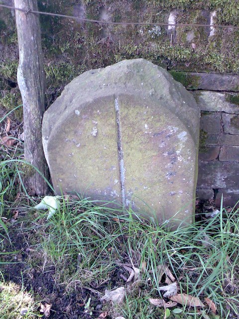
Old Bridge Marker near Dunford Bridge
County Bridge Marker 150 metres east of Dunford Bridge on the south side of the road. Dunford parish formerly the West Riding of Yorkshire and now South Yorkshire. No inscription, just a vertical line. Not on any current boundary but in the style of nearby boundary markers. It has been classed as a county bridge marker marking the extent of roadway adjoining the bridge that the County was obliged to maintain, given its proximity to the bridge.
Milestone Society National ID: YW_DUNF01br
Milestone Society National ID: YW_DUNF01br
National Survey of Wayside Features by The Milestone Society
These images are from Link
 Map © Crown Copyright")
TIP: Click the map for more Large scale mapping
- Grid Square
- SE1502, 156 images (more nearby 🔍)
- Photographer
- D Garside (more nearby)
- Contributed by
- Mike Rayner (more nearby)
- Date Taken
- Wednesday, 6 February, 2019 (more nearby)
- Submitted
- Wednesday, 20 May, 2020
- Subject Location
-
OSGB36:
 SE 15857 02472 [1m precision]
WGS84: 53:31.1211N 1:45.7391W - Camera Location
-
OSGB36: SE 15857 02472
- View Direction
- Southeast (about 135 degrees)