2020
SE3624 : Path on the riverbank near Bottomboat Reach
taken 4 years ago, near to Bottom Boat, Wakefield, England
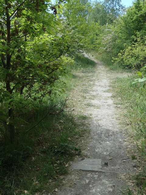
Path on the riverbank near Bottomboat Reach
In the second half of the 20th century this was the route of a railway taking waste from local collieries to be dumped on the north bank of the Calder. There's a wooden railway sleeper in the foreground.
 Map © Crown Copyright")
TIP: Click the map for more Large scale mapping
- Grid Square
- SE3624, 57 images (more nearby 🔍)
- Photographer
- Christine Johnstone (more nearby)
- Date Taken
- Tuesday, 19 May, 2020 (more nearby)
- Submitted
- Saturday, 23 May, 2020
- Subject Location
-
OSGB36:
 SE 3664 2486 [10m precision]
WGS84: 53:43.1323N 1:26.7756W - Camera Location
-
OSGB36: SE 3665 2486
- View Direction
- West-southwest (about 247 degrees)