1976
NN3139 : Northwestwards from Coire an Dothaidh 1976
taken 48 years ago, near to Bridge of Orchy, Argyll And Bute, Scotland
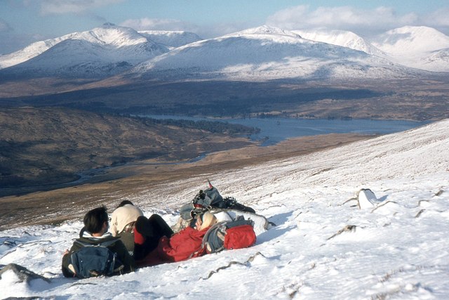
Northwestwards from Coire an Dothaidh 1976
Looking across Loch Tulla to the Black Mount with Stob Ghabhar to the left.
 Map © Crown Copyright")
TIP: Click the map for more Large scale mapping
- Grid Square
- NN3139, 18 images (more nearby 🔍)
- Photographer
- Jim Barton (more nearby)
- Date Taken
- Sunday, 1 February, 1976 (more nearby)
- Submitted
- Saturday, 23 May, 2020
- Subject Location
-
OSGB36:
 NN 316 399 [100m precision]
WGS84: 56:31.2593N 4:44.3190W - Camera Location
-
OSGB36: NN 316 399
- View Direction
- Northwest (about 315 degrees)