2020
SE5082 : Happy Valley
taken 4 years ago, 3 km from Sutton-Under-Whitestonecliffe, North Yorkshire, England
This is 1 of 2 images, with title Happy Valley in this square
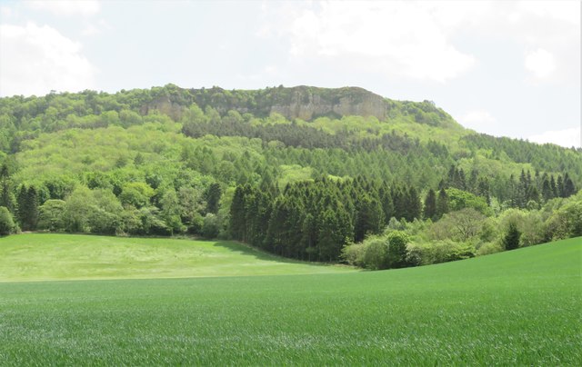
Happy Valley
I wasn't sure where this name had originated, but checking back through old maps I see that 'Happy Valley' has been so named for at least the last century. Farmland gives way to woodland and then the cliffs of Roulston Scar at the south western corner of the Hambleton Hills.
 Map © Crown Copyright")
TIP: Click the map for more Large scale mapping
- Grid Square
- SE5082, 47 images (more nearby 🔍)
- Photographer
- Gordon Hatton (more nearby)
- Date Taken
- Friday, 22 May, 2020 (more nearby)
- Submitted
- Sunday, 24 May, 2020
- Subject Location
-
OSGB36:
 SE 5062 8212 [10m precision]
WGS84: 54:13.9376N 1:13.4967W - Camera Location
-
OSGB36: SE 5051 8222
- View Direction
- Southeast (about 135 degrees)